Company
Services
ProductsHow we workFor partners Contact

Mobility Technology (MobTech)

Computer transport models and mobility data

Software, computer models and data platforms for cities, road authorities and infrastructure developers.
From data to decisions.

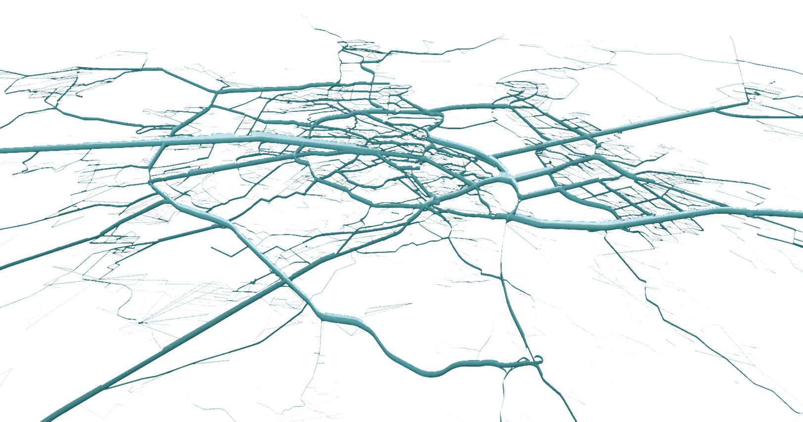
Modelled traffic volumes across a city road network, drawn as a 3-D band plot where band width and colour encode the load on each link

About us

A mobility technology company since 2007

Decisions about how people and goods move commit money for decades. We compute them before they are built.

ProMobility is a Ukrainian mobility technology company, founded in Kyiv in 2007 and resident of Diia.City. Until 2021 it traded as A+S Ukraine; it is the same legal entity, EDRPOU 35634432, with no Russian or Belarusian shareholders.

Projects since 2007
300+
Reference letters from clients and donors
60+
Countries
11
Director
Dmytro Bespalov
Deputy Director
Maksym Dorosh
Director of Transport Modelling
Volodymyr Tarasiuk

Services

From a regional strategic model to a single junction

Digital Transport Models


We build macro and micro computer transport models, forecast demand, and run the scenarios automatically.

Learn more

Intelligent Transport Systems


ITS architecture, adaptive control algorithms, public transport priority logic and real-time management software.

Learn more

Mobility Data Processing


Digital data capture on our own platforms, automated GPS trace processing and OD matrix estimation.

Learn more

Public Transport Network Optimisation


Calibrated network models and algorithmic route and headway optimisation for bus, tram and metro operators.

Learn more

Platforms for Mobility Data Collection


Software platforms for automated mobility data collection, with datasets the modelling software reads directly.

Learn more
Transport modelling & simulation

Digital Transport Models

We build calibrated, auditable computer transport models of urban and regional mobility. We develop macro and micro simulation models in PTV Visum and PTV Vissim, install and configure the software within the client’s IT environment, and extend it with our own scripts where standard functionality ends.

Every model is documented, version-controlled and calibrated against observed data to a criterion agreed with the client. It is handed over as working software the client can run and check. A calibrated model is a digital twin of the transport network: the same links, the same demand, and every scenario tested on it before anything is built.

Core services

  • Macroscopic and strategic computer network models (PTV Visum)
  • Microsimulation of intersections, corridors and interchanges (PTV Vissim)
  • Travel demand forecasting and automated multi-scenario processing
  • Traffic impact assessment for new developments and infrastructure schemes
  • Development and simulation-based testing of signal timing and coordination plans
  • Custom scripting and automation of model workflows (Python, COM API)
  • Demand and revenue forecasts prepared as inputs to appraisal under the EC Guide to Cost-Benefit Analysis of Investment Projects
  • Models developed and validated to the JASPERS guidance on the use of transport models in transport planning and project appraisal, and to DfT Transport Analysis Guidance units M3.1 and M3.2 (GEH below 5 on more than 85% of links); microsimulation to FGSV guidance; capacity analysis to HCM or HBS
ITS architecture & control software

Intelligent Transport Systems

An Intelligent Transport System is an integrated system of hardware, software and communications, and we design and implement it as one. Our engineers develop the ITS architecture, specify and integrate the software components, and build the adaptive control and public transport priority algorithms that run on top of them.

We cover needs analysis, system architecture, specification and performance validation, and every control strategy is tested in a simulation model before it is used on the road network.

Core services

  • ITS architecture design for integrated hardware, software and communication systems
  • Development and configuration of adaptive signal control algorithms
  • Public transport priority logic and bus lane management
  • Software for traveller information systems and variable message sign networks
  • Specification and acceptance testing of real-time traffic management platforms
  • ITS architecture to ISO 14813, traffic data exchange in DATEX II (CEN/TS 16157), to EU Directive 2010/40/EU
Mobility data processing software

Mobility Data Processing

Our applications record field observations on the spot, on an ordinary phone, with GPS tagging. Our pipelines then process large volumes of GPS, probe, sensor and operator data, with automatic quality checks at every step.

We design the study methodology, configure the capture workflows, and run quality control, so the datasets are traceable and load into computer transport modelling software without conversion. Where a site has no sensors, or the survey design is unusual, we run the same pipeline in semi-automated mode: field crews capture on our application, and the processing and the quality checks stay automatic.

Core services

  • Digital traffic and pedestrian count workflows (video and sensor data processing)
  • On-board passenger flow data capture through the TransitWand application
  • Origin-Destination (OD) matrix estimation from GPS and mobile network data, validated against traffic counts
  • Automated road surface condition processing (IRI estimation from mobile sensor data)
  • Automated data quality control and model-ready dataset generation
  • Semi-automated capture for sites without sensors, with automatic processing and quality control
  • Data handled under the GDPR, with a data processing agreement and an agreed anonymisation method
Public transport data & optimisation algorithms

Public Transport Network Optimisation

We process ridership, automatic vehicle location (AVL) and passenger flow data, build a calibrated computer model of the operator’s network, and run algorithmic optimisation to compute and compare restructuring scenarios against real operational constraints: vehicle availability, crew schedules, infrastructure limits.

We deliver the comparison in numbers and the tools that produced it. The operator keeps the model, reruns it as demand shifts, and decides on the network using the numbers.

Core services

  • Automated processing of ridership, AVL and passenger flow data
  • Calibrated computer model of the operator’s network and demand
  • Algorithmic route and headway optimisation inside the model
  • Analysis of interchanges and network connectivity
  • Automated scenario comparison and performance benchmarking reports
  • Passenger flow data capture through the TransitWand platform
  • Network and timetable data in GTFS, NeTEx (CEN/TS 16614) and SIRI (CEN/TS 15531)
Platforms for mobility data collection

Platforms for Mobility Data Collection

We build and deploy software platforms that automate the slowest steps in transport data work. Our tools collect data on ordinary mobile phones and process large volumes of GPS and probe data with automatic quality checks, and export to GIS, GTFS and transport modelling software.

We use these platforms in our own projects, and they are available as licensed products for operators and research teams who need scalable, repeatable data collection infrastructure inside their own organisation.

Core services

  • TransitWand: mobile application for on-board boarding and alighting data capture
  • RoadWand: road surface condition monitoring and IRI estimation from mobile phone sensors
  • MobilityWand: large-scale GPS trace and mobile network data processing for OD matrix estimation
  • GTFS, GIS and transport model compatible data export modules
  • Automated quality control pipelines and reproducible data workflows
  • TransitWand, RoadWand and MobilityWand: onboarding for client teams
  • Road surface condition to ASTM E1926 and World Bank Technical Paper 46; spatial data to OGC standards and INSPIRE

Products

Built by our own team

TransitWand

Automates passenger flow data collection during on-board surveys. Exports to GIS, GTFS and transport models.

Learn more

RoadWand

RoadWand assesses road surface condition automatically. It estimates the International Roughness Index (IRI) from mobile phone sensors.

Learn more

MobilityWand

A data platform that processes mobile network data and GPS traces into model-ready mobility indicators and Origin-Destination (OD) matrices.

Learn more

Native Android and iOS apps, a Java and Spring Boot back end on PostgreSQL. Technology

Public transport data capture software

TransitWand

TransitWand turns an ordinary smartphone into a data capture instrument for on-board passenger surveys. The application records passenger flow data automatically, which removes manual counting and the processing of paper reports, and produces datasets for public transport planning software.

Core capabilities

  • Flexible configuration of on-board survey parameters
  • Reliable data synchronisation and storage in field conditions
  • Data export to formats compatible with GIS, GTFS and transport models
  • Runs on Android and iOS

Target application

Public transport

Stop-level passenger counts on bus and tram routes

Challenge
Manual counts on paper are slow and error-prone, and take weeks to digitise before the data can be used.
Proposed solution
Surveyors record boardings and alightings on TransitWand; every record is GPS-tagged and synchronised to the server.
Expected value
Stop-level passenger flow data available as soon as the survey ends, ready for the transport model.

Download TransitWand

Get it on Google PlayDownload on the App Store
TransitWand start screen
TransitWand during an on-board survey: stops, boarding and alighting

See TransitWand on your data.

Contact us
Road network analysis

RoadWand

RoadWand monitors the condition of road infrastructure. The application estimates the International Roughness Index (IRI) from mobile phone sensors in real time, at ASTM E1926 Class 3 level, and the estimate is correlated against reference profilometer measurements. The tool gives road authorities a repeatable picture of network condition without expensive specialised hardware.

Core capabilities

  • Real-time estimation of the International Roughness Index (IRI)
  • Location tagging of rough road sections
  • Data export to infrastructure management systems
  • Data capture with ordinary mobile phones, without special equipment

Target application

Road infrastructure

Continuous surface condition monitoring

Challenge
Road authorities often lack up-to-date data to set maintenance priorities across large road networks.
Proposed solution
Mobile network scanning using the RoadWand app to automatically compute IRI metrics and record geolocation during routine drives.
Expected value
Repair budgets allocated on measured condition, and fewer manual condition inspections.

See RoadWand on your data.

Contact us
Multimodal mobility data

MobilityWand

MobilityWand is our analytical platform for complex transport studies. It processes anonymised mobile network data and GPS traces into clean, structured output, with expansion factors and validation against traffic counts. MobilityWand stores and processes the data from TransitWand and RoadWand in one place, which gives planners a continuous picture of city-wide mobility patterns.

Core capabilities

  • Processing and validation of GPS traces and mobile probe data
  • OD matrix estimation from multi-source mobile network data
  • Automated quality control and generation of mobility indicators
  • Reproducible data pipelines for computer transport modelling

Target application

Urban mobility

Measuring city-wide travel patterns from mobile data

Challenge
Household surveys are costly and infrequent, and they do not capture day-to-day mobility patterns across a whole metropolitan area.
Proposed solution
Processing anonymised GPS traces and mobile device data through the MobilityWand platform to continuously capture actual travel behaviour.
Expected value
Origin-Destination matrices built on measured movement and expanded to the full population, which reduces reliance on infrequent manual surveys.

See MobilityWand on your data.

Contact us

How we work

The same five steps on every project

From the first meeting to handover, whatever the size of the task.
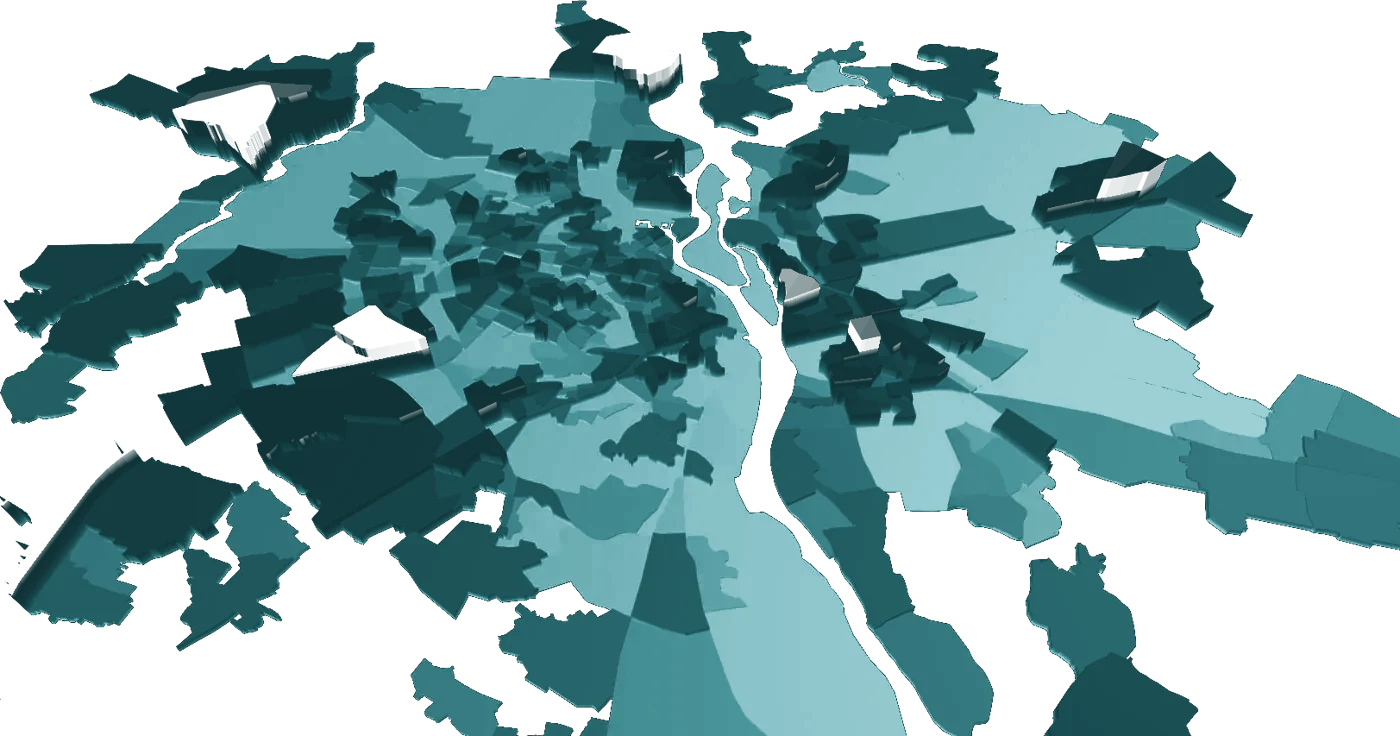
Transport zones of a computer transport model of Kyiv, drawn in 3-D
  1. 01

    Define

    Agree the decision, the scope and the indicators with the client.

  2. 02

    Measure

    Collect field, sensor and operator data and check its quality.

  3. 03

    Build

    Build the model, data pipeline or software the task needs.

  4. 04

    Validate

    Test the model and software against measured data.

  5. 05

    Transfer

    Train the client’s team and hand over the tools and documentation.

For partners

Working with us on a bid

Consortium partner or subcontractor

On programmes financed by international financial institutions.

Documents for the bid

Key expert CVs in EU Annex IV, EBRD and GIZ formats, reference letters and project sheets.

Your data stays yours

NDA before any exchange. GDPR data processing agreement before any data transfer.

What you own after handover

Full transfer, licence to use or hosted service, agreed in the contract.

Contact

Write to us

About a project or a joint bid. We reply within two working days.

Emailinfo@pro-mobility.org

Projects delivered in Ukraine, Moldova, Georgia, Uzbekistan, Armenia, Azerbaijan, Albania, Saudi Arabia, Germany, the Czech Republic and Slovakia.